Salt air, sunrise views, and a quick Metro-North ride to the city make Riverside waterfront living hard to resist. If you are eyeing the Mianus River or Long Island Sound, you are also balancing practical questions about flood risk, docks, moorings, and permits. The good news is you can plan for these details with clear steps and the right team. In this guide, you will learn what matters most, how to check it, and how to budget with confidence. Let’s dive in.
Why Riverside waterfront appeals
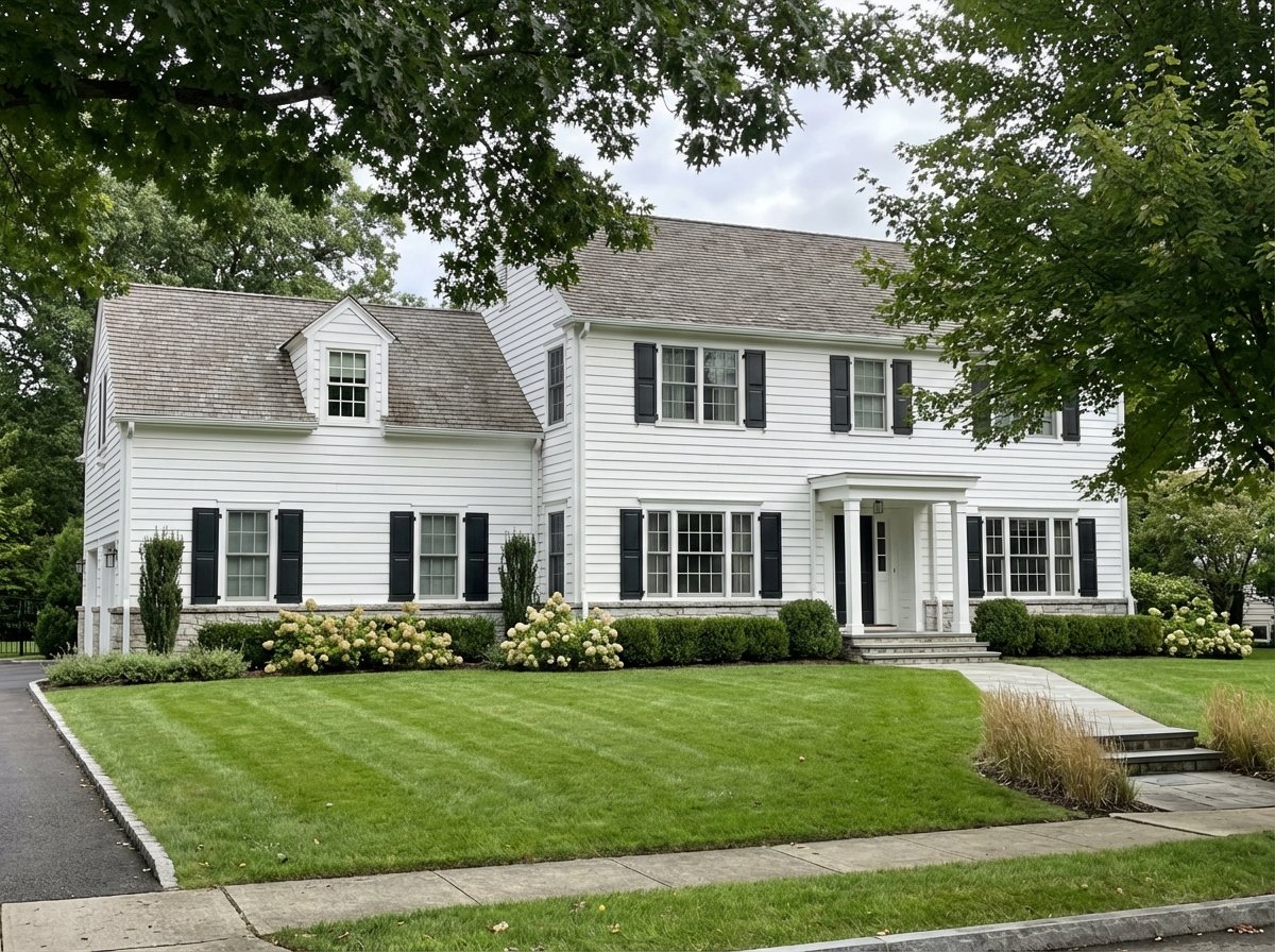
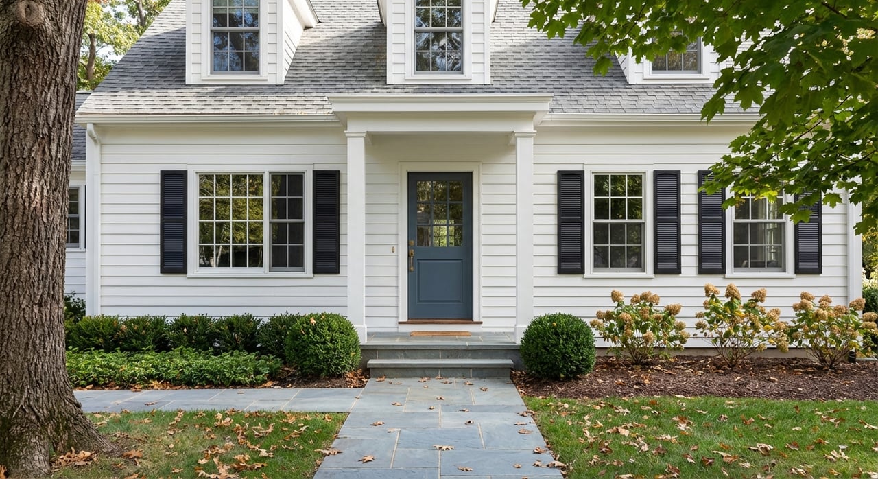
Riverside sits within the Town of Greenwich in Fairfield County, wrapped by the Mianus River to the west and Long Island Sound to the south. You get village-scale amenities, commuter access at the Riverside Metro-North station, and an active boating culture shaped by local clubs and mooring fields. Housing ranges from cottages and renovated homes to substantial estates along the first row of water.
First-row lots on the Sound or the Mianus River typically command a premium because of direct views and access. For lifestyle context on Riverside’s setting and mix of homes, explore this neighborhood overview of Riverside in Greenwich. (Corcoran neighborhood guide)
Flood risk 101 in Riverside
Waterfront beauty comes with coastal and river dynamics. In Riverside, you will see riverine flooding from the Mianus River and tidal surge and wave action from Long Island Sound. The exact risk for any parcel is specific, so start here.
Check your FEMA flood map
FEMA’s Flood Insurance Rate Maps identify Special Flood Hazard Areas, Base Flood Elevations, and regulatory floodways. Before you submit an offer, pull the official FIRM panel for the exact parcel and note the zone designation and BFE. This sets the baseline for insurance, permitting, and renovation decisions. (FEMA Map Service Center)
The 50 percent renovation rule in Greenwich
Greenwich reviews renovation and repair scopes against a substantial improvement standard. If cumulative work equals or exceeds 50 percent of the structure’s pre-work market value, the home must meet current floodplain requirements. That can mean elevating living areas above BFE, moving mechanicals, and limiting uses below the BFE. Build this checkpoint into your due diligence and renovation budgets. (Greenwich substantial improvement guidance)
Elevation certificates and LOMAs
An Elevation Certificate from a licensed surveyor shows how the home’s lowest floor sits relative to BFE. Lenders and the National Flood Insurance Program use it to determine coverage requirements and rates. If your structure is above BFE, the certificate can reduce premiums or help with lender decisions. If it is below BFE, expect higher premiums and more stringent building rules. (FEMA Elevation Certificate form used in Greenwich)
Insurance and Risk Rating 2.0
You can insure through the NFIP or private flood carriers. FEMA’s Risk Rating 2.0 prices policies using property-specific factors like distance to water, elevation, and flood sources. Many coastal owners have seen changes under this system. Most NFIP policies carry a 30-day waiting period, so request quotes early in your process and share results with your lender. (FloodSmart overview of NFIP benefits and Risk Rating 2.0)
How flood status affects financing
If your parcel is in a Special Flood Hazard Area and you use a federally regulated lender, flood insurance will be required and often escrowed. Lenders consider local floodplain rules and any renovation plans that might change risk. Confirm insurance acceptance and closing timelines with your lender as soon as you have preliminary quotes and an Elevation Certificate. (Greenwich substantial improvement guidance)
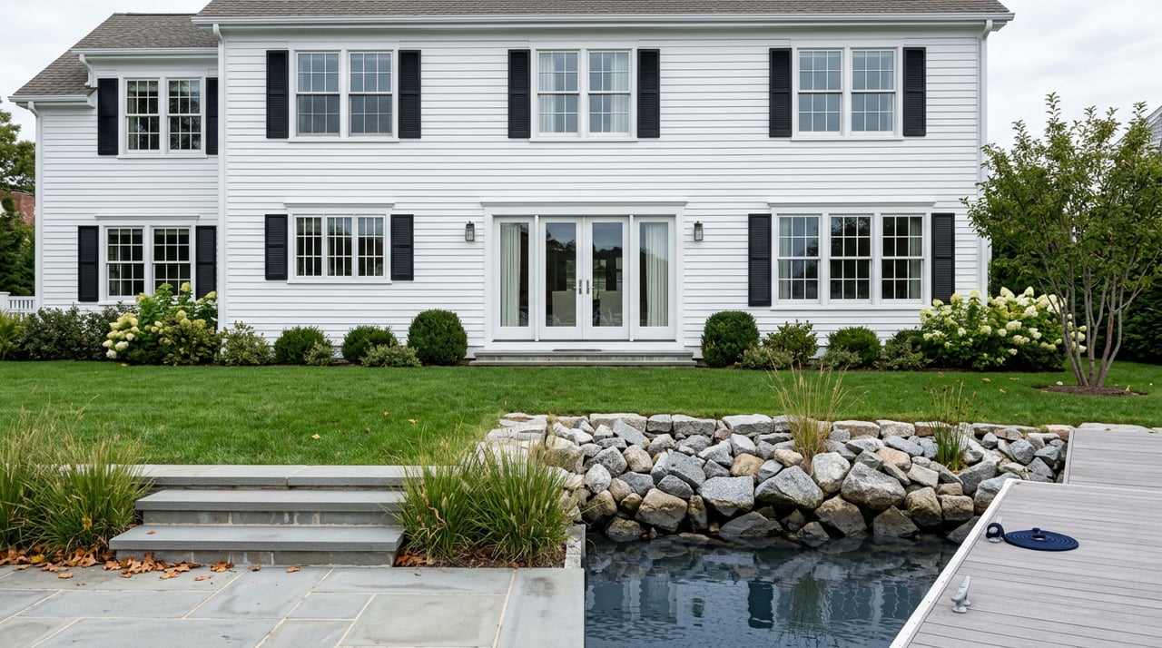
Docks, moorings, and access
Access to the water is central to Riverside living. The rules are layered across local, state, and federal authorities.
Title rights versus permits
Waterfront owners often hold littoral or riparian rights that include access to the water and a qualified right to wharf out. These rights do not guarantee approval for new structures. They are subject to town, state, and federal regulations for navigation and environmental protection. Always review your deed and recorded easements to verify any private beach or dock access before you assume what is allowed.
Greenwich mooring process
Greenwich’s Harbor Management Commission and Harbormaster oversee mooring placement, annual permits, waitlists, and inspection requirements. Some mooring fields are tied to yacht clubs, others are public. Waitlists for popular areas can take multiple seasons. If a boat is part of your plan, check the process, required insurance, and inspection cadence early. (Greenwich mooring award and placement process)
For broader context on navigational priorities and mooring field maps, the Harbor Management Plan is a helpful reference. (Greenwich Harbor Management Plan)
State and federal permits for docks and seawalls
Any work waterward of the Coastal Jurisdiction Line, such as docks, pilings, seawalls, or dredging, typically needs Connecticut DEEP authorization. Many projects also require U.S. Army Corps review or eligibility under general permits. Minor residential docks may qualify for general permits, while larger projects often require individual permits and public notice. Plan for surveys, engineering, and processing time. (CT DEEP coastal permits overview)
Practical limits on private docks
Even where title rights exist, local harbor management controls placement for public safety and navigation. Depth changes, navigation channels, habitat like shellfish beds, and neighboring moorings can affect what is permitted. Expect vendor inspections, approved mooring tackle, and periodic renewals set by the town.
Renovations and shoreline work
If you plan to update a waterfront home, confirm how rules and permits shape scope, cost, and timing.
When projects trigger compliance
Large renovations or storm repairs that meet the 50 percent threshold trigger full floodplain compliance. That can change design choices, utility locations, and allowable uses for lower levels. Ask for any prior claims, permits, or certificates from the seller to understand history and potential obligations. (Greenwich substantial improvement guidance)
Seawalls and living shorelines
Shoreline stabilization is regulated in Connecticut. DEEP reviews hard structures like seawalls and riprap, and it often encourages living shoreline or nature-based solutions where feasible. An experienced coastal engineer can help you evaluate options and likely permit pathways. (CT DEEP coastal permits overview)
Permit timelines and public notice
Processing times vary by project complexity. Smaller qualifying docks under a general permit may move faster. New seawalls, dredging, or larger structures can require months, full applications, public notice, and potentially hearings. Build permitting and engineering into your closing and construction timelines. (CT DEEP coastal permits overview)
Market signals and budgeting basics
Riverside is one of Greenwich’s higher-price areas, with a spectrum of housing that includes first-row waterfront estates. Direct waterfront and dock potential tend to drive premiums relative to inland locations. Use fresh, street-level comps during negotiations to reflect view corridors, elevation, and access.
When planning your budget, line up quotes early. Here are common items buyers consider:
- Flood insurance quotes under NFIP and private carriers. Risk Rating 2.0 uses property-specific inputs, so premiums vary widely by elevation, distance to water, and foundation type. (FloodSmart overview)
- Mooring expenses, including any application fees, annual permit renewals, proof of insurance, and required vendor inspections in Greenwich. (Greenwich mooring award and placement process)
- Engineering and permit costs for docks or shoreline stabilization, plus potential environmental surveys. (CT DEEP coastal permits overview)
- Dock construction varies significantly by site and system. Planning references show wide ranges from tens to triple digits per square foot depending on floating versus fixed systems, pilings, utilities, and site prep. Treat these as preliminary ranges only and request local bids. (Industry planning manual)
Buyer due diligence checklist
Use this quick list to structure your offer timelines and contingencies:
Pull the exact FIRM panel and Flood Insurance Study for the parcel. Confirm whether the home is in an A, AE, or VE zone and note the BFE. (FEMA Map Service Center)
Order an Elevation Certificate from a licensed surveyor or ask the seller for a recent one. This directly affects insurance and lender requirements. (Elevation Certificate form)
Request the seller’s flood policy details, any recent claims, and any LOMA or prior elevation documentation. Obtain quotes under Risk Rating 2.0 from NFIP and private carriers. (FloodSmart overview)
Verify water access rights. Check deeds for beach or dock easements and confirm mooring waitlist status and managed fields with the Harbor office. (Greenwich mooring award and placement process)
If you plan renovations, run your scope through Greenwich’s substantial improvement review before you finalize the deal. Budget for compliance work if the 50 percent threshold is likely. (Greenwich substantial improvement guidance)
For seawalls, docks, or dredging, consult a marine engineer and confirm permit pathways and timing with DEEP. Build contingencies into closing and construction schedules. (CT DEEP coastal permits overview)
Plan for future conditions
Connecticut’s coastal planning uses scenarios that anticipate up to roughly 20 inches of sea-level rise by 2050. While not a precise forecast, it is a practical planning benchmark for design, insurance, and resale decisions. Ask your engineer and insurer how this guidance shapes recommended elevations and resilient features for the property you are evaluating. (CIRCA sea-level rise viewer and guidance)
Ready to explore Riverside waterfront?
Buying on the water is a lifestyle choice and an investment. When you understand flood mapping, insurance, access rights, and permits, you can move forward with clarity. If you are considering Riverside or neighboring Old Greenwich, get local guidance that blends coastal insight with thoughtful presentation. Connect with Nora Giovati to preview the right homes and plan a confident offer.
FAQs
What is Riverside in Greenwich, CT, and why does it attract buyers?
- Riverside is a Greenwich neighborhood along the Mianus River and Long Island Sound with village amenities, train access, and an active boating culture, which together draw buyers seeking coastal lifestyle and convenience. (Corcoran neighborhood guide)
How do I find my property’s flood zone and BFE in Riverside?
- Use FEMA’s Map Service Center to pull the exact FIRM panel for your parcel and note the zone and Base Flood Elevation, then confirm details with a licensed surveyor. (FEMA Map Service Center)
What does Greenwich’s 50 percent substantial improvement rule mean for renovations?
- If your project’s cumulative cost reaches 50 percent or more of the home’s pre-work market value, you must bring the structure into compliance with current floodplain standards, which can include elevating living areas and moving mechanicals. (Greenwich substantial improvement guidance)
Do I automatically get a dock or mooring with a Riverside waterfront home?
- No. Title rights are subject to town, state, and federal rules, mooring fields are managed with permits and waitlists, and any new or modified structures typically need DEEP and possibly Army Corps authorization. (Greenwich mooring process) (CT DEEP coastal permits overview)
How does Risk Rating 2.0 affect flood insurance costs for Riverside homes?
- NFIP pricing now uses property-specific factors like elevation and distance to water, so premiums vary by home; get quotes early and share them with your lender to confirm requirements and timing. (FloodSmart overview)